Sand Dunes - Introduction
Key Findings
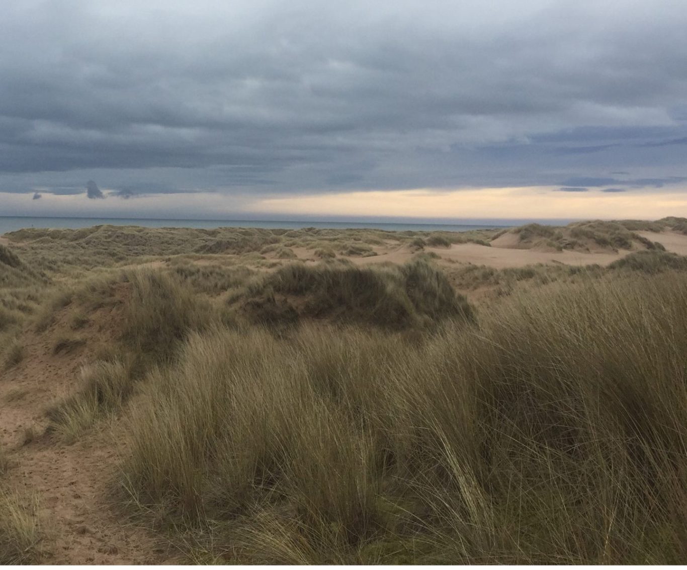
Sand dunes are a dry, salty, unstable and nutrient-poor coastal margin habitat (fig. 1) (Lake et al, 2015). There are five recognisable zones which can be identified within a dune system (NatureScot, 2023), starting with the strandline on the beach, moving inland to the fore dune, mobile dune, fixed dune, and finishing with dune slacks furthest inland (fig. 2). Sand dunes form through natural processes of wind and tides, with sand transported to an area which is then stabilised by vegetation or beach debrisand builds up over time (Jones et al, 2011).
Scotland has over 50,000 ha of sand dunes, which makes up over 70% of Great Britains coastal sand resources (NatureScot, 2023). Locations of dune systems along the east coast include St Cyrus, Stonehaven, Aberdeen to Forvie, Cruden Bay, and Peterhead to Fraserburgh (fig. 3). The stretch of dune system between Donmouth in Aberdeen to Forvie National Nature Reserve at Newburgh is over 14 miles long (Aberdeenshire Council, n.d.).
Biodiversity:
The differing zones within a dune system experience different levels of wind speed, sea-spray, and sand mobility, and this then influences the plant communities found within each zone. Sand dunes are characterised by specialist plant species adapted to the more stark conditions, such as marram grass (Ammophilia arenaria). As the sand dune heads inland, limited numbers of pioneering plant species are then replaced by more diverse vegetation communities (Lake et al, 2015). Broad sand dune habitats inlude dune heath, dune grassland, and dune slacks (Jones et al, 2011).
There are over 100 invertebrate species in the UK restricted to sand dune habitats, with hundreds more species associated with sand dunes for breeding, over-wintering, and feeding during their life cycle (Lake et al, 2015).
At the Sands of Forvie on the east coast, ground-nesting birds such as eider ducks and terns will nest within the dune system. The area supports nationally scarce plant species such as creeping lady's tresses (Goodyera repens) and curved sedge (Carex maritima). Various butterfly and moth species have been recorded at Forvie NNR, including priority UK Biodiversity Action Plan (UKBAP) species such as small pearl-bordered fritillary (Boloria selene) (NatureScot, n.d.).
Ecosystem Services (Jones et al, 2011):
Sand dunes provide a number of ecosystem services, following the four classifications introduced in the Millenium Ecosystem Assessment (2005).
Supporting: Like many habitats, sand dunes support primary production, water cycling, soil formation, and nutrient cycling.
Provisioning: In some locations in Scotland, sand dunes are used for grazing livestock for provisioning of wool and meat. Dune grasses have historically been used for thatching and basket-weaving. Space for wild species diversity - invertebrates, birds, and plants.
Regulating: Hazard regulation, as a sea-defence, giving protection from erosion, coastal flooding, and storm & wave damage. Sand dunes will absorb and dissipate wave energy, protecting residential and agricultural areas inland. Sand dunes can also regulate water quality through purification of groundwater.
Cultural: Sand dunes are of high importance as a resource for education, public knowledge, and scientific study, as an area for recreation (walking, camping, birdwatching), as an area for wellbeing (exercise, local meaningful space, wilderness), and as a source of aesthetic views and inspiration for art and culture. Sand dunes and beaches are often a major reason for visiting the coast, and are believed to be the most popular semi-natural habitat in the UK in terms of visitor numbers.
Conservation Status:
UKBAP: Priority Habitat (BRIG, 2007)
Scottish Biodiversity List: Priority Habitat (NatureScot, 2020)
Of the 70,000 ha of sand dunes within the UK, Special Areas of Conservation (SACs) provide protection for around 15,000 ha (Jones et al, 2011).

fig. 1: (Charlotte Tomlinson) - Sand dunes at Forvie NNR

fig. 2: (Dawson et al, n.d.) Transect of sand dune system

fig. 3: NMPi - Dune System from Peterhead to Fraserburgh
Notes
None
Linked Information Sheets
Key sources of Information
Aberdeenshire Council (no date) Beaches
BRIG (2007) Report on the Species and Habitat Review
Dawson et al (n.d.) Sand Dunes
Jones et al (2011) Coastal Margins - The UK National Ecosystem Assessment Technical Report
Lake et al (2015) Britain's Habitats
Millennium Ecosystem Assessment (2005) Ecosystems and Human Well-being: Synthesis
NatureScot (no date) The Story of Forvie National Nature Reserve
Reviewed on/by
Status
First Draft
To report errors, highlight new data, or discuss alternative interpretations, please complete the form below and we will aim to respond to you within 28 days
Contact us
Telephone: 07971149117
E-mail: ian.hay@stateofthecoast.scot
We need your consent to load the translations
We use a third-party service to translate the website content that may collect data about your activity. Please review the details in the privacy policy and accept the service to view the translations.

